

Following the swan – a walk down the Lea Valley – part 1
The Lea is Hertfordshire’s principal river, flowing for 58 miles from its source at Leagrave near Luton to the Thames; with its tributaries it drains over half the county. The Lea Valley Walk covers 53½ miles, because its route takes some short-cuts and meanders less. CPRE Hertfordshire’s Elizabeth Hamilton describes the first part of the Walk including some fascinating historical context, and points of interest along the way.
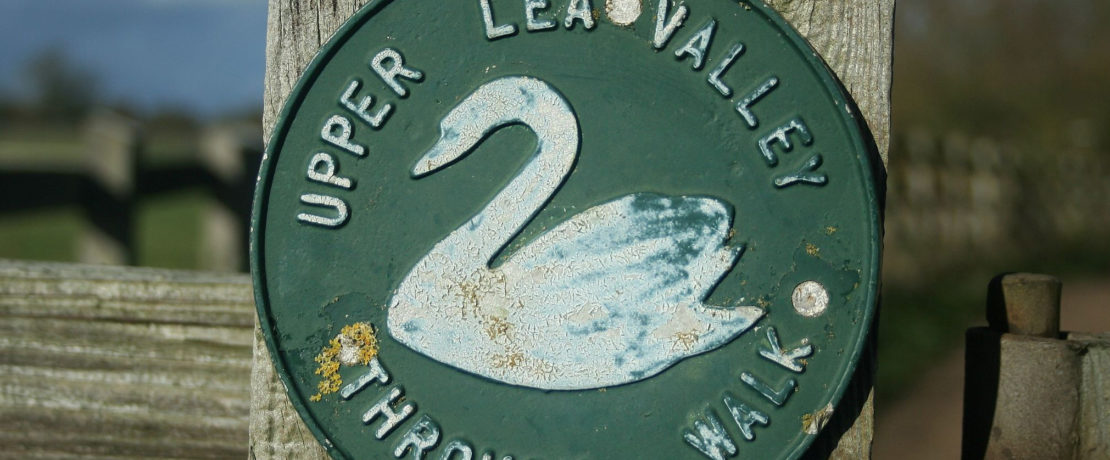
Formally opened in 1993 when waymarking with the swan logo was completed, the Lea Valley Walk was created by a partnership of local authorities and volunteer groups. The Cicerone guide (third edition published in 2015) is full of information about the river and its valley. The waymarks are mostly still in place.
Maps of the physical geography of Hertfordshire show a distinct valley running SW-NE across the county, the Vale of St Albans. It was eroded by an ancient river Thames (the proto-Thames) which once rose in north Wales, ran through the west Midlands and flowed out through Essex towards what is now the Norfolk coast. Some of the sand and gravel it deposited, which has been extensively quarried, originated from rocks in Wales and the Midlands. The upper Lea was originally a left-bank tributary of the proto-Thames.
During the Anglian glaciation, a massive ice sheet reached further south in Britain and northern Europe than any ice advance in modern times (meaning within the last 2 million years). The Anglian glaciation lasted from around 475,000 to 425,000 years ago. At its furthest point in our area it reached Bricket Wood and down to Finchley. The ice blocked the course of the proto-Thames, diverting its waters down the valley of one of its right-bank tributaries (the proto-Medway), in what is now the lower Lea Valley. Later the Thames reversed completely and eventually assumed its current course. The central section of the Lea valley was once the proto-Thames valley.
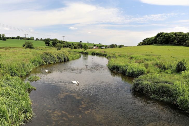
The official source of the river Lea is at Well Head in Leagrave, where five springs feed the infant river and several small spring-fed tributaries join the river early on. The springs arise from the chalk aquifer so the Lea is a chalk stream, although much altered by urbanisation. Over 80% of the world’s chalk streams occur in England and Hertfordshire’s rivers which flow down the chalk dip-slope are a significant element of that number. As the Lea crosses Leagrave Marsh, a short distance from Well Head, it has already grown into an attractive stream. This area was once a grazed common, known as ‘the beach’ and a popular bathing spot.
Early names for the Lea were Lygean or Ligean, named after the Celtic god Lugus. The Celts or British regarded rivers as sacred, and often ceremonial or sacred monuments are found near river sources. The Lea is no exception and Waulud’s Bank, a massive 4,000 year old neolithic henge, is near to Well Head.
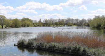
Until the Walk reaches the towpath of the Lea Navigation which begins in Hertford, it is often some distance from the river and the route is an exploration of the valley rather than a close companion of the riverbank. Within a mile of the source, at Limbury, there was a substantial Roman settlement, now an area of grassland and lush riverside vegetation; nearby is the site of a Roman cemetery. The Walk struggles to stick close to the Lea through much of Luton, so some of the walking is along suburban streets. In Wardown Park, an 11-acre public park opened in 1906, the Lea creates a lake, having been dammed in Victorian times by the previous owner of Wardown. Several more lakes are encountered on the way downstream.
Beyond Wardown the river disappears into a culvert under the town centre, and the Walk takes you overground, past two buildings of note: firstly the classical meets art deco town hall completed in 1936. It was built using fire-proof materials after its predecessor burnt down during the peace day riots of 19 July 1919, when ex-servicemen complained about their conditions in the peace. The Statue of Peace in front is a war memorial completed in 1922. St Mary’s church is the largest parish church in Bedfordshire, mainly 14th and 15th century although there has been a church here for over 1000 years. Its chequerboard flint and chalk construction is typical of this part of the Chilterns.
Luton was once a major hat-making centre, supplied by straw plait made mainly by women and children, often in rural homes, sweatshops and the infamous plait schools. There are still local companies engaged in the trade. As it emerges from the town centre the Lea is still very urbanised. Swan logos set in the pavements help walkers find their way. Beyond the Vauxhall HQ and the airport, the Walk reaches open countryside south of Luton. In 2009 this part of the route was altered and improved, now shared by part of the national cycle network. It climbs steeply to a hilltop from where there is a view over the parkland of Luton Hoo.
From here into Harpenden the Walk runs along the trackbed of the former Luton, Dunstable and Welwyn railway, 24 miles long and opened in 1860. It connected to the main line at Welwyn and later at Hatfield, with stations at Luton Hoo, Harpenden East, Wheathampstead and Ayot. The line closed in 1965.
After 8½ miles in Bedfordshire the Walk passes under the Midland main line and enters Hertfordshire at East Hyde, a very rural place. A considerable volume of extra water is fed into the river from the sewage works just upstream.
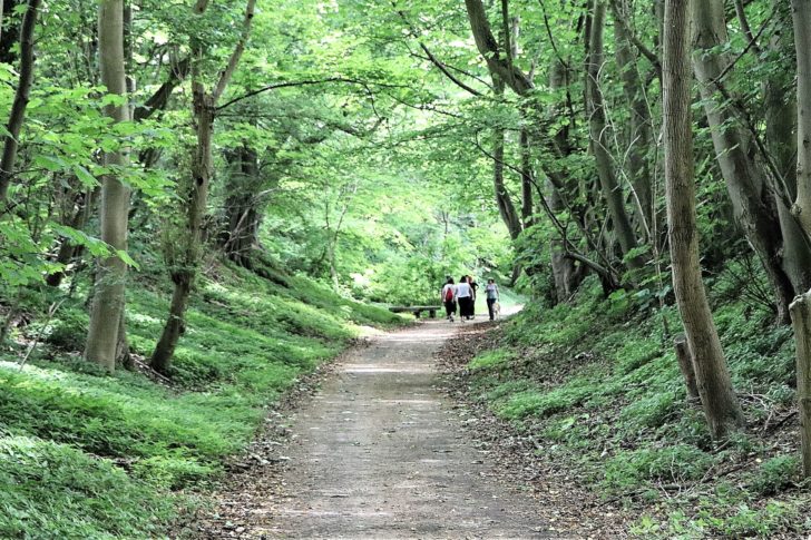
The Walk continues along the old railway line running between trees above the right bank to reach Harpenden. Just before the site of Harpenden East station the route leaves the old line and drops down to the riverside at Batford Springs.
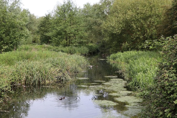
This is where the Lea Valley Walk was born. The 3.5 hectare site is a local nature reserve managed by Harpenden Town Council and the Batford Springs Volunteers, a group previously known as the Upper Lea Valley group and founded in 1971 by the Harpenden Society. This group created a riverside walk here which grew eventually into the Lea Valley Walk. Once an area growing willow for basketry with watercress beds fed by water from a borehole which still operates, the site includes reedbeds, wet woodland and meadows with birds like sedge and reed warblers and reed buntings.
Beyond Batford the Walk leaves the river again and resumes its route along the old railway line, then there is a brief climb to fields higher above the valley. Two miles after leaving Batford the Walk reaches Wheathampstead. This was a significant iron-age settlement and probably a tribal capital, one of a number in the county referred to by archaeologists as oppida. Before the Roman invasion the inhabitants were already trading with the Roman empire in wine and oil, using coinage and working metal.
The church has Saxon origins although its present fabric is mainly 13th and 14th century. The distinctive ‘witch’s hat’ spire dates from 1859. In the church there is a memorial to Apsley Cherry Garrard, who went to Antarctica with Scott and survived to write the classic account of that fateful journey. He lived at nearly Lamer and was a great friend of George Bernard Shaw.
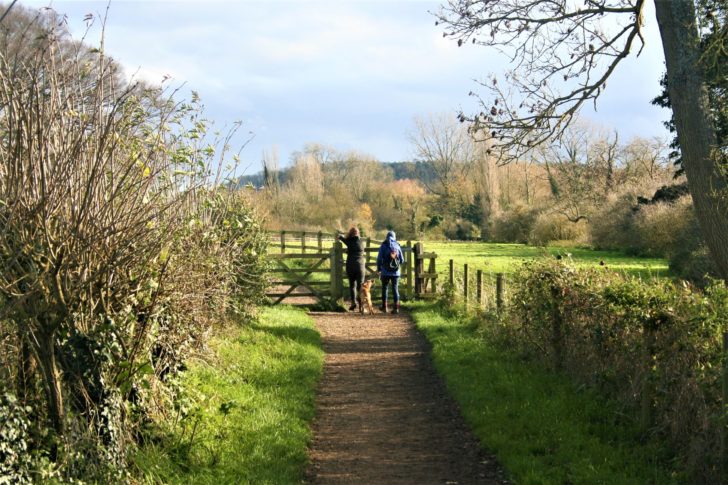
Below the village the river runs through public open space. Here it is shallow, wide and fast-flowing over a gravel bed: typical characteristics of chalk streams. Near the bypass the river crosses The Hertfordshire Way and continues eastwards through pastureland for 2 miles before reaching Brocket Hall. The valley narrows and deepens, and feels very secluded, with meanders and wet or carr woodland with alder and willow trees, which like to have their roots in water or damp ground. The woodland looks messy but is a rich wildlife habitat. This is one of my favourite parts of the Walk.
At Waterend the ford is close to an early 17th century house, the birthplace of Sarah Jennings, who became Duchess of Marlborough and confidant of Queen Anne. A barn which once stood here was moved to St Albans – I can remember going to the restaurant it housed when I was a child to eat knickerbocker glories.
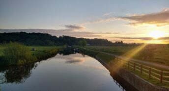
Downstream the Walk suddenly ascends to higher land among trees and then enters the parkland of Brocket Hall, with glimpses of the lake created by damming the Lea – the Broadwater – with its famous bridge built by James Paine, who also rebuilt the house between 1760 and 1780. Brocket has had numerous famous and infamous occupants, some well-known like Lord Melbourne and his wife Lady Caroline Lamb, and Lord Palmerston, Lord M’s brother-in-law. They were both Prime Minister. Less well-known is Lord Mount Stephen who built the Canadian Pacific railway and later lived at Brocket. He died there in 1921 and is buried in Lemsford. From Brocket the Walk runs downhill to return to the riverside briefly at Lemsford, beside the mill.
The stretch from Leagrave to Lemsford is approximately 15 miles. Leagrave station is on the Thameslink line. The 366 bus serves Lemsford (where there is some roadside parking) and runs through East Hyde to Luton (but not on Sundays or Bank holidays). The 8 mile stretch from East Hyde to Lemsford is one of the most rural parts of the entire Walk. For a shorter route the 3 mile section between Wheathampstead and Lemsford is definitely recommended – you can use the same bus. Full bus service details are at www.intalink.org.uk
Read about the next section of the walk in Following the Swan – a walk down the Lea Valley – part 2.
—
To learn more about The Lea Valley Walk, you might like to buy a copy of the official guidebook and walk some or all of the route yourself. Or if you’d like to learn more about the history, people and places along the route, you can arrange for Elizabeth Hamilton to visit your group and provide an illustrated talk of her experiences walking along The Lea.
For more information about our work to promote and protect the Hertfordshire countryside, please sign up below for our newsletter.