

Following the Swan – a walk down the Lea Valley – part 3
The Lea is Hertfordshire’s principal river, flowing for 58 miles from its source at Leagrave near Luton to the Thames; with its tributaries it drains over half the county. The Lea Valley Walk covers 53½ miles, because its route takes some short-cuts and meanders less.
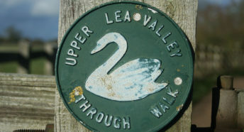
The Cicerone guide (third edition published in 2015) is the authoritative source of information on The Lea Valley Walk. Here in part 3, CPRE Hertfordshire’s Elizabeth Hamilton describes the third part of the Walk – from Hertford to the county boundary at the M25 – including historical context and points of interest.
– – –
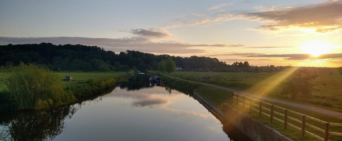
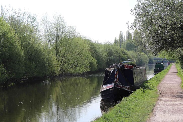
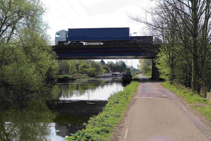
Below Hertford the river Lea becomes a grown-up waterway, transformed after 1767 by 18 locks and a towpath into the Lea (or Lee) Navigation, built to promote trade between the riverside towns and London. Horse-drawn lighters were still being pulled up to Hertford until 1950. The Lea Valley Walk follows the towpath for the rest of its route in Hertfordshire. Although this part of the Walk passes close to some of the busiest built-up areas of the county, the towpath feels rural for much of the way. The path’s good surface makes it ideal for a walk or cycle ride.
Both spellings of the river’s name are used. When the engineer John Smeaton designed the Navigation, he used the name Lee. Smeaton is perhaps better known for the lighthouse he built on the Eddystone Rocks near Plymouth, which now stands on Plymouth Hoe. On the other hand the 2012 Olympic Park was officially located in the Lower Lea Valley.
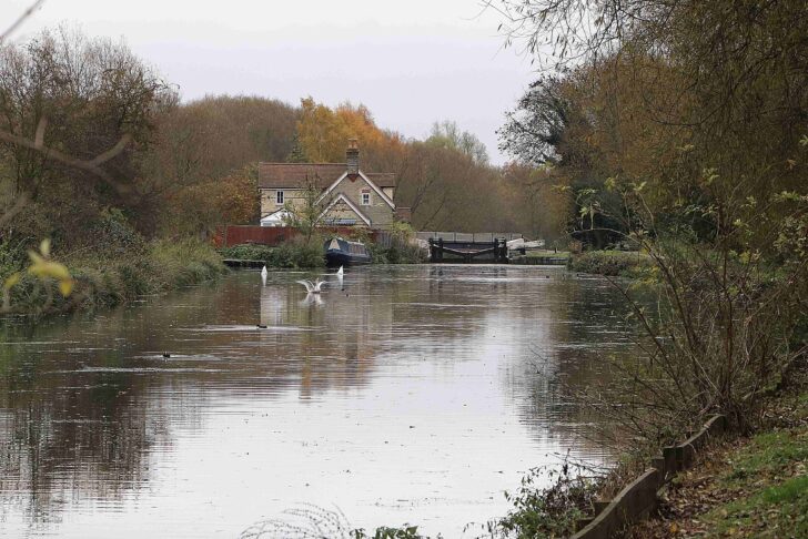
From the edge of Hertford by the highest lock on the Navigation there is a wide-ranging view over King’s Meads, a marshy meadowland managed by the Herts and Middlesex Wildlife Trust. Just below here the waters of the river Beane, and shortly afterwards those of the river Rib, join the Lea from the north. A little further on water flows from the Lea under the brick-built New Gauge to supply the start of the New River. This is a 17th century aqueduct created to bring water to the City of London.
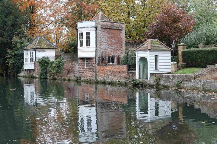
After a peaceful tree-lined stretch the river flows past the famous 18th century gazebos in Ware. These were built by innkeepers keen to provide a peaceful place for their customers away from the noise and dust of Ware’s high street, which was often busy with carts going to the many malthouses in the town. Further on former malthouses still line the river, now converted to other uses. The malting trade flourished in Ware from the 14th century and brought prosperity to the town and its rural hinterland. The ending of malt production in the town in 1994 also ended most commercial barge traffic on the river.
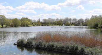
Below Ware the river enters the Lee Valley Regional Park. Its 10,000 acres (4,046 hectares) were designated in 1967, and the park runs alongside the river for 26 miles into London. Significant features of the park are numerous lakes formed from former gravel workings. The gravel was laid down by melt water flowing out from the ice sheet which reached southern England around 450,000 years ago. At times ice flowed down into what is now the Lea Valley, reaching as far as modern-day Hoddesdon. Many of the flooded gravel pits and their marshy surroundings have become rich wildlife habitats. They are renowned for wintering wildfowl and rare birds like bittern and osprey, as well as dragonflies, otters and over 500 plant species.
Below Ware the old river Lea separates from the Navigation, one of several places where the two channels divide. The two miles of the Navigation towpath between Ware and the twin settlements of St Margarets and Stanstead Abbots are especially peaceful. Hardmead Lock is located on this relatively isolated stretch, quite different from the busier sections of the Navigation further south. Just downstream, the river Ash flows from its quiet valley enclosed by wooded hillsides to join the Lea from the east.
For a 4-mile circular walk start at Ware and head downstream on the Lea towpath to the bridge at Stanstead Abbotts. Turn right onto the road here and pass St Margarets station, then soon afterwards take the New River path back to Ware. The New River path is not all hard-surfaced and can become muddy.
Below Stanstead Abbotts a marina provides services for boats using the river, now mainly pleasure craft. After passing under the bridge carrying the busy A414 road the towpath resumes its tranquillity for a while. At Rye House it is worth crossing the bridge to explore the Rye House gatehouse, the only remains of a 15th century house which was home to the Parr family, most notably Catherine who was Henry VIII’s last queen. Later Rye House was the centre of a failed plot to assassinate Charles II and his brother James (who became James II). The gatehouse is renowned for its very early brickwork, including an impressive chimney built in the ’barley stick’ style. Opposite, the Rye House inn has striking 17th century windows.
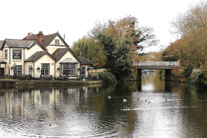
Beyond Rye House the tranquillity of the towpath is affected by busy commercial buildings and a power station. Here the river Stort, also a ‘navigation’, joins the Lea on the left bank. At Dobb’s Weir the Fish and Eels pub was frequented by Izaak Walton, who found inspiration from the river Lea for his book The Compleat Angler, first published in 1653. There’s another peaceful stretch beyond the weir as far as Broxbourne station.
Below Broxbourne the Walk continues along a peaceful four-mile stretch of the Lea Navigation towpath to the bridge linking the twin settlements of Waltham Cross (in Hertfordshire) and Waltham Abbey (in Essex). Much of the adjoining land is former marshland or flooded gravel workings, now included in the River Lee Country Park, where visitors can enjoy activities including water sports, cycling, walking and bird watching.
Just before reaching the path which links the towpath to Cheshunt station the Walk passes the lake housing the Herts Young Mariners Base. A little further on the Lee Valley White Water Centre built for the London 2012 Olympics can be reached from the towpath. Here people of all ages can take part in activities on and in the water. There are café and bar facilities as well as a chance to watch competitive kayaking or canoeing action. The Centre is open from Wednesday to Sunday.
On the opposite bank the concrete platform which housed a Bofors anti-aircraft gun during the Second World War is just visible: the gun was positioned there to protect the nearby Royal Gunpowder Mills, now an extensive museum (tickets must be bought online in advance). The Mills supplied explosives throughout Britain and the world for 300 years, making use of a network of waterways to transport materials around the site, since water transport was safer than carrying materials by horse-drawn carts.
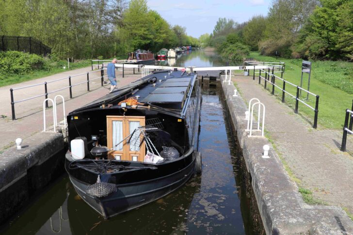
A mile to the south of Cheshunt the lock by Waltham Town Bridge marks the spot where it is believed that the first ‘pound’ lock was established In England. Prior to this time river navigation was improved by single, vertically lifting gates called staunches, which allowed a head of water to build up-upstream of the gate. As a boat travelled downstream the gate was lifted to allow it through. Boats heading upstream had to be winched past the staunch.
From this point a detour to the west reaches the Eleanor Cross in Waltham Cross, marking one of the places where the body of Queen Eleanor, the wife of Edward I, was rested on its journey from Lincoln to Charing Cross following her death in 1250. Turn east to venture into Essex and explore Waltham Abbey church and the ruins of the monastery at this historic site.
From the Waltham bridge it is barely half a mile of walking, alongside a busy industrial estate, to reach the bridge carrying the seemingly unending traffic of the M25 over the river. Here Hertfordshire’s river Lea ends and London’s river begins.
If you want to continue to follow the Lea Valley Walk, it runs for a further 14 miles to reach the Thames opposite the Greenwich Peninsula. There’s a second final stretch, following the Limehouse Cut which runs for 1½ miles to Limehouse Basin. The Cut was opened in 1770 to enable river traffic to bypass the tidal part of the Lea and avoid the long journey on the Thames around the Isle of Dogs to reach the City. There are a number of public transport options to facilitate walking the London section of the Walk in shorter stages.
Hertford to Broxbourne is 6 miles. Broxbourne to Waltham Bridge is 4¼ miles, then it’s barely half a mile to the M25.
From the M25, rail stations are at Enfield Lock (1¼ miles south), Waltham Cross (just over a mile north then west) and Cheshunt (just under 2 miles north).
– – –
To learn more about The Lea Valley Walk, you may wish to buy a copy of the official guidebook and walk some or all of the route yourself. Or if you’d like to learn more about the history, people and places along the route, you can arrange for Elizabeth Hamilton to visit your group and provide an illustrated talk of her experiences walking along The Lea.
For more information about our work to promote and protect the Hertfordshire countryside, please sign up below for our newsletter.